Maps locating Chatter Creek


Three depths of map locating Chatter Creek Snowcat Skiing in Western Canada's British Columbia, just north of the town of Golden BC. These MSN "MapPoint" maps are available on the MSN Maps & Directions Web site. Click on any map image to enlarge it, use the browser's "Back" button to return.
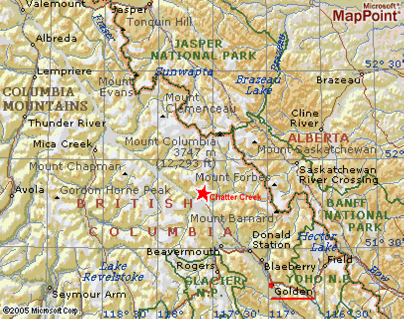
Map 1 locates Chatter Creek north of Golden BC, south of Jasper National Park and just west of Banff National Park. Chatter Creek is in the Canadian Rocky Mountains.
Map 2 locates Chatter Creek between the SelKirk Mountains (mis-labeled on the map) to the west of Kinbasket Lake and the great icefields of the Rocky Mountains, to the east and north.
Map 3 locates Chatter Creek just southeast of the Clemenceau Icefield and just southwest of Mt Columbia, the Snow Domes and the Columbia Icefield, all of which are all easily visible from Chatter Creek's Vertebrae Glacier. For more information, see "Where is Chatter Creek" and Travel Information for Golden BC
Back to Index
posted by Chatter Editor @ 8:57 AM
0 comments
![]()

0 Comments:
Post a Comment
<< Home