Chatter News Photo Galleries & Information on Cat Skiing ____________________________________
| Chatter News | Road to Vertebrae Glacier | Glacier Skiing | Bombardier Snowcat | Favorites |
| Lodge Life | Vertebrae Lodge | Solitude Lodge | Happy Campers | Pink Purse | Winter Staff |
Ski Photography by: | John Dougall | Mark Gallup | Dan Hudson | About Us | Site Map | Index |
| Chatter Creek Cat Skiing | Clamshell | Cut Blocks | East Ridge | Lodge Ridge | Great Links |
| Cat Skiing Terrain | Cat Skiing Articles | Flight to Chatter Creek | Travel to Golden | Email |

Tuesday, August 09, 2005

Ski Runs at Chatter Creek Snowcat Skiing

This ski weblog lists the ski runs, major ski areas and land features at Chatter Creek Snowcat Skiing, located in the Canadian Rocky Mountains near Golden BC.

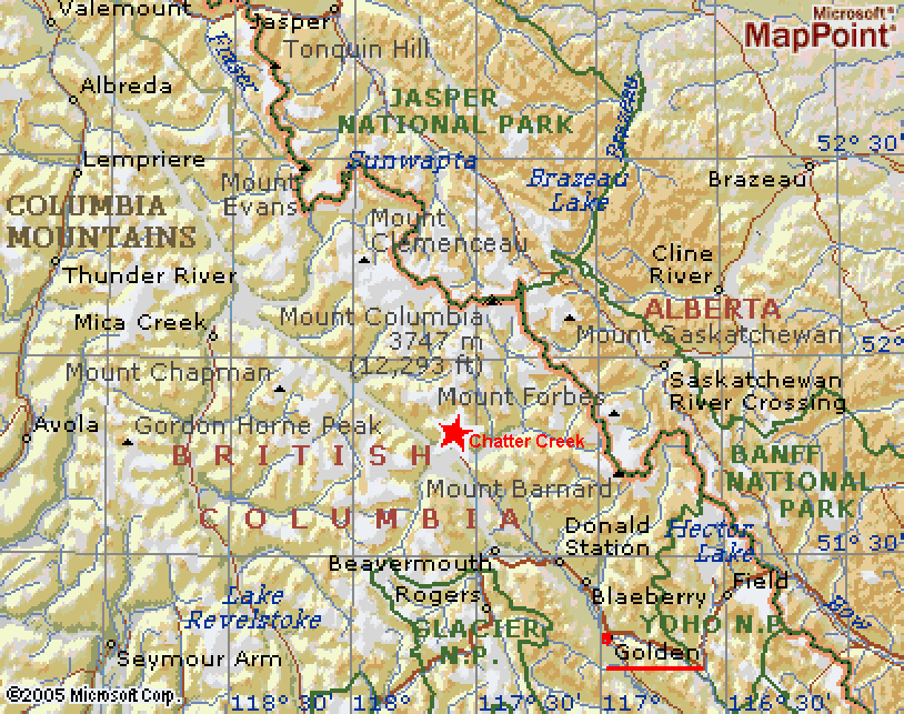
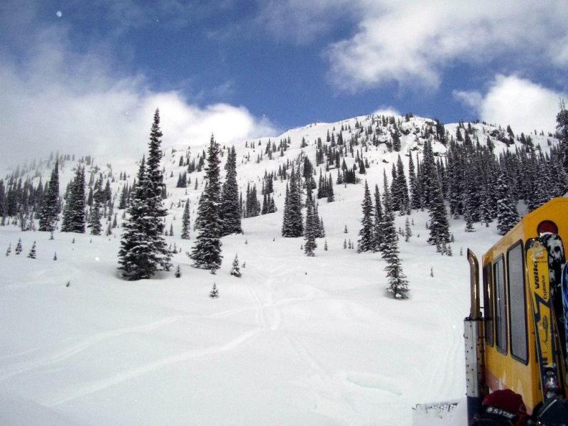
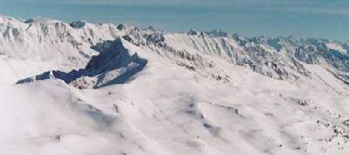
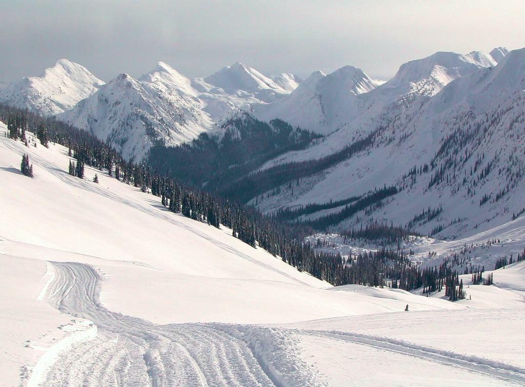
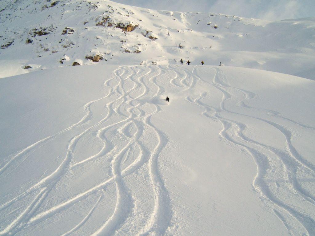
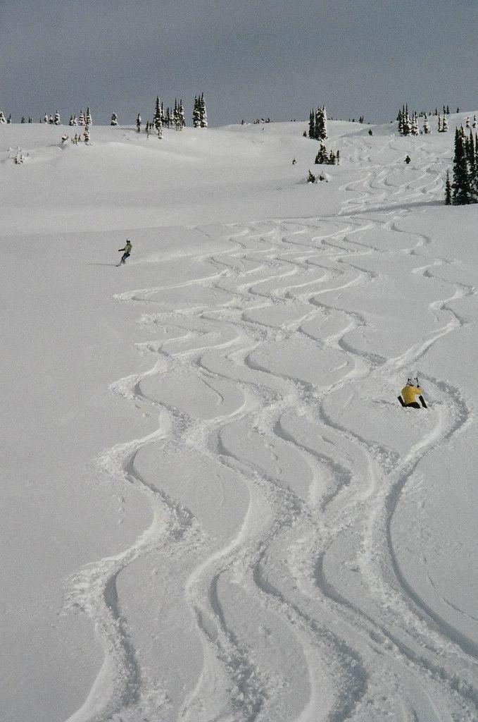
The ski runs and ski areas appear alphabetically, grouped by major cat skiing zone. This is work in progress. Scroll down or use the links in the following index. Click any ski photo to enlarge it.

This is part of the Chatter News family of ski weblogs about Chatter Creek. The links at the top of the page connect to the Chatter News and some if it's related ski weblogs.

General
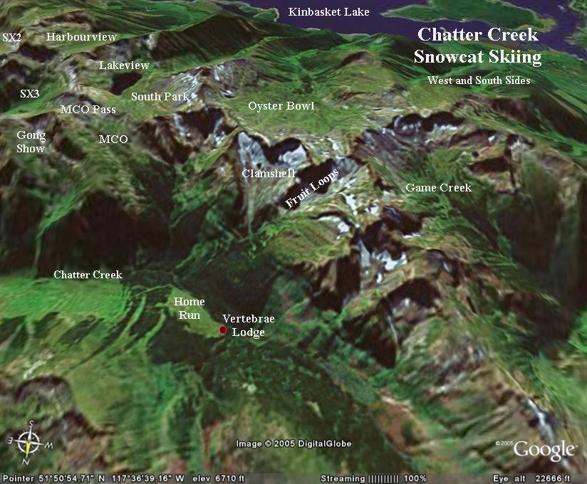
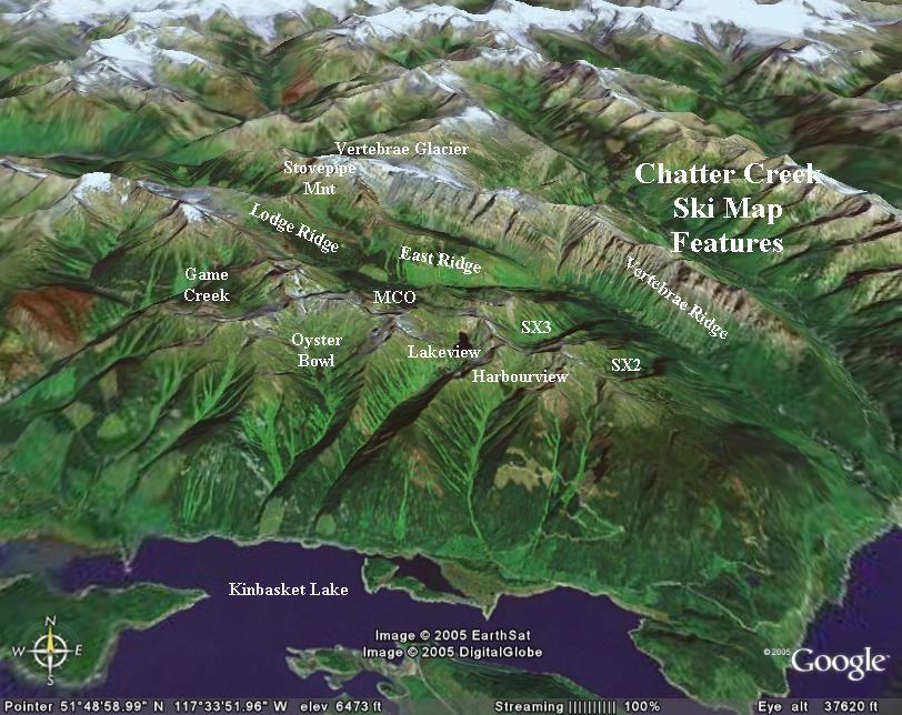
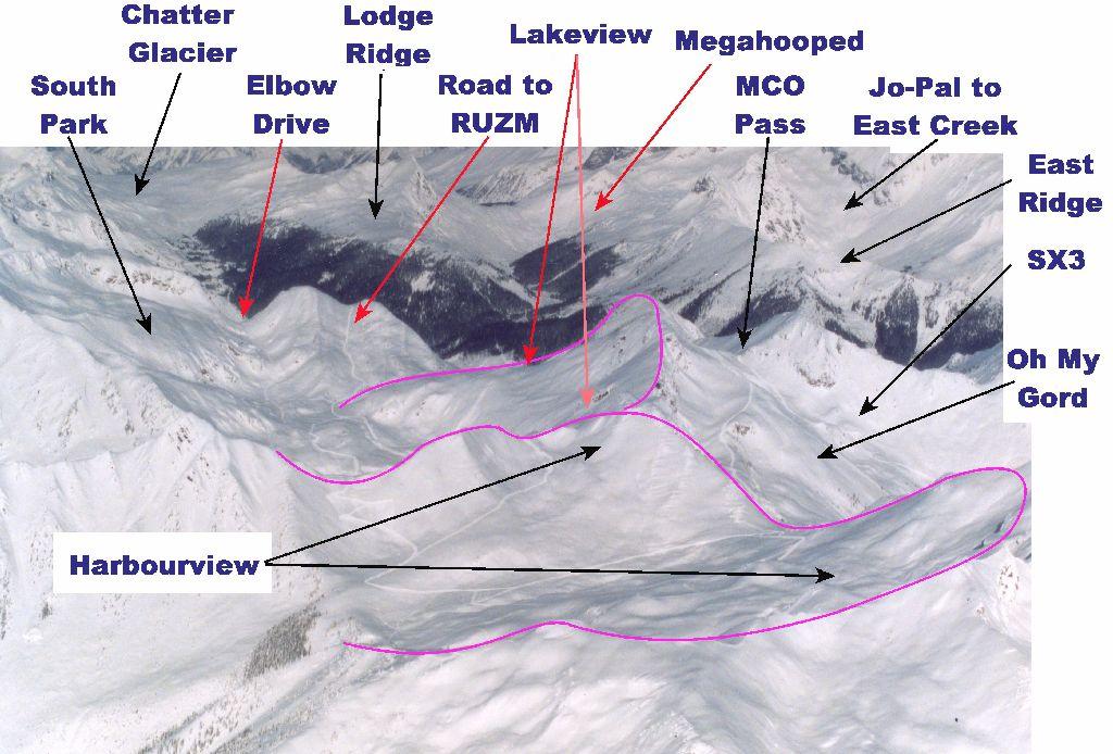
Maps Locating Chatter Creek,    Cat Road Network,    3D Satellite Images
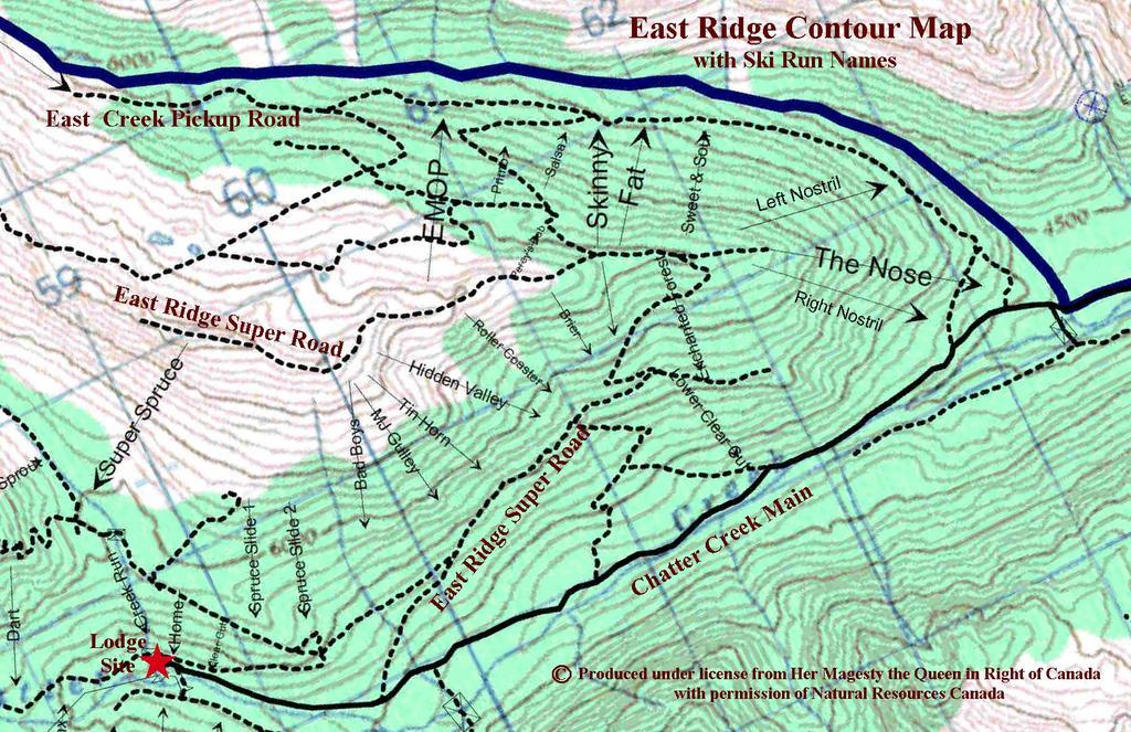
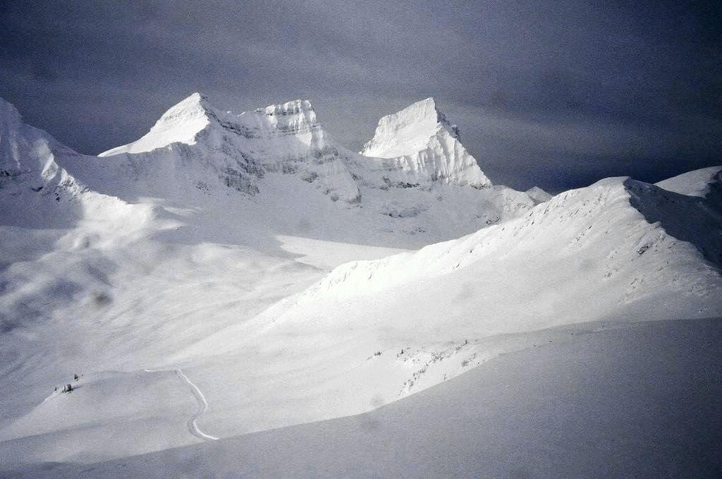
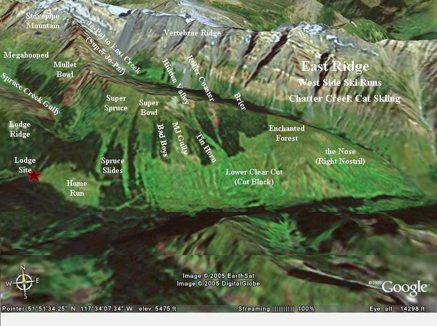
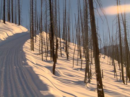
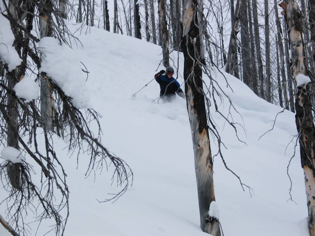
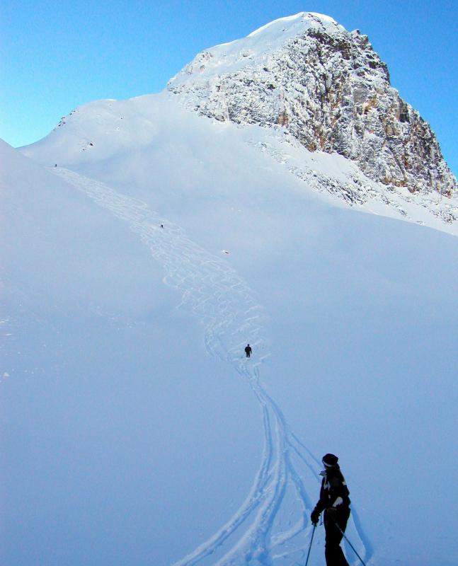
East Ridge
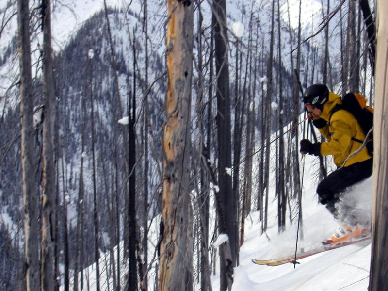
Enchanted Forest,    the Nose,    Sweet & Sour, the Fat and the Skinny,    Spruce Slide,    Super Spruce and Super Bowl,    Tree Skiing (miscellaneous runs)

Lodge Ridge
Crystal Light, Far Out, Pillow Talk & Waterfall,    Dewar's Bowl,    Home Run,    Mommy's Run

South Side
Anticipation Peak,    Harbourview,    Lakeview,    MCO,    RUZM Gully and Rugi,    South Park,    SX2,    SX3


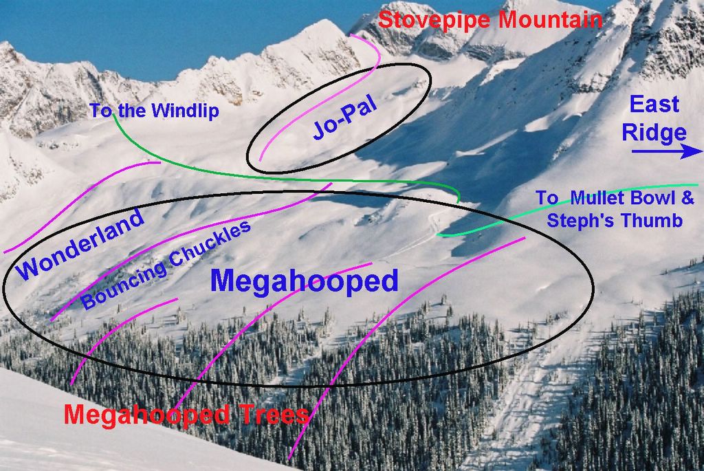
Stovepipe Mountain and North Side
Bouncing Chuckles,    Jo-Pal and Jo-Pal to East Creek,    Megahooped & Megahooped Trees,    Mullet Bowl,    Spruce Pass and the Golf Course,    Terrain North of Vertebrae Glacier,    Vertebrae Glacier,    Windlip,    Wonderland

West Side and the new Lakeside Addition
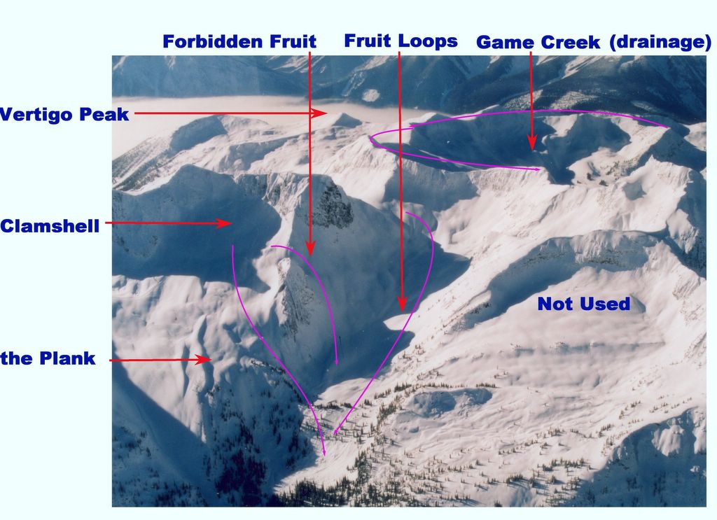
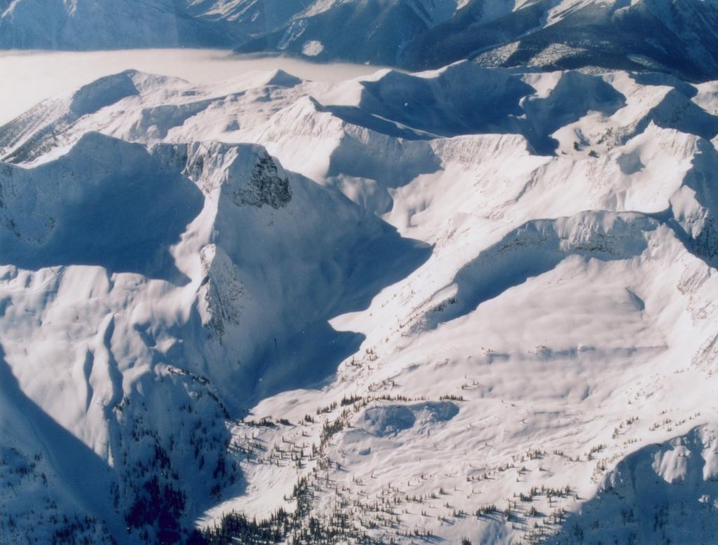
Clamshell,    Fruit Loops and Forbidden Fruit,    Game Creek,    Oyster Bowl,    Staff Trees & Bermuda Triangle,    Waterfall

Index of (all) Names related to Chatter Creek: - A to D, E to K, L to R, S to Z (with links to ski photos and related information)

Alphabetical Listing of Ski Run Names

Sunday, August 07, 2005

Maps locating Chatter Creek


Three depths of map locating Chatter Creek Snowcat Skiing in Western Canada's British Columbia, just north of the town of Golden BC. These MSN "MapPoint" maps are available on the MSN Maps & Directions Web site. Click on any map image to enlarge it, use the browser's "Back" button to return.
Map 1 locates Chatter Creek north of Golden BC, south of Jasper National Park and just west of Banff National Park. Chatter Creek is in the Canadian Rocky Mountains.
Map 2 locates Chatter Creek between the SelKirk Mountains (mis-labeled on the map) to the west of Kinbasket Lake and the great icefields of the Rocky Mountains, to the east and north.
Map 3 locates Chatter Creek just southeast of the Clemenceau Icefield and just southwest of Mt Columbia, the Snow Domes and the Columbia Icefield, all of which are all easily visible from Chatter Creek's Vertebrae Glacier. For more information, see "Where is Chatter Creek" and Travel Information for Golden BC
                                                 Back to Index

Cat Road Network


The Chatter Creek Ski Run Index is organized by cat road network as described in Cat Skiing Terrain. Each network is a maze of access roads and pickup roads that accesses one or more major skiing zone(s). Each zone would constitute a large ski area. Most zones are named according to their location relative to Vertebrae Lodge, Chatter Creeks remote mountain lodge.

   1. South Side Super Road
   2. West Side Road to Oyster Bowl & Game Creek (Lakeside Addition)
   3. Lodge Ridge Road East ridge Cat Roads and Ski Runs at Chatter Creek
   4. Road to Vertebrae Glacier & Chatter North
   5. East Ridge Road Super Road

The images show a Chatter Creek snowcat on the col between Harbourview and Lakeview and a contour map showing the cat roads and named ski runs on East Ridge. The viewpoint in the first image is across Lakeview towards Stovepipe Mountain, in the far distance.

An aspect of cat skiing at Chatter Creek is that the network of pickup roads permit skiers and riders to be picked up, each run, where the good skiing ends. There is no skiing down cat roads and through poor or skied-out terrain to reach a common pickup point.                               Back to Index

Saturday, August 06, 2005

Anticipation Peak

Anticipation Peak is in the MCO ski zone. It provides a number of steep slopes with one, Smoking Herb (towards the left of the first photo) being quite steep. (named after veteran guide Herb Bleuer). The photos above are all the work of Chatter Creek's in-house pro photographer, John Dougall.              Back to Index

Bouncing Chuckles

Jo-Pal and Megahooped Ski Runs Bouncing Chuckles is a an area of broken terrain low on the west side of Stovepipe Mountain, in the center of Megahooped. It lies just south of Wonderland. Bouncing Chuckles ends just north of the Megahooped Trees and just above the bottom of the Golf Course. Bouncing Chuckles offers a number of lines through wide openings and draws in a broken cliff area with some sparse trees.              Back to Index

Crystal Light, Far Out, Pillow Talk & Waterfall

Ryan Jones & Friends on Crystal Lite on Lodge Ridge at Chatter Creek Adjacent to Mommy's Run, Far Out, Crystal Light, Pillow Talk and Waterfall lie on the east side of Lodge Ridge and descend from the crest of the ridge to the Spruce Creek gully, at the foot of the Megahooped Trees. The pickup road for these side-by-side runs is the Road to Vertebrae glacier and to Spruce Pass. The first photo shows the southern end of Lodge Ridge and the ski runs "Far Out" and "Crystal Light". The second photo shows "Mommy's Run", Pillow Talk" and "Waterfall". The third image is taken on Crystal Light. See Mommy's Run for more photos. The order of the runs is Far Out, closest to the south end of the ridge, followed by Crystal Light, Mommys' Run, Pillow Talk and lastly Waterfall, furthest to the north and closest to Spruce Pass and the Golf Course. Please note that we have also used the name "Waterfall" for steep feature on the outrun from Forbidden Fruit and Fruit Loops (See the Clamshell)

Dewar's Bowl

Dewar's Bowl is located on the west side of upper Lodge Ridge and forms part of the Chatter Creek drainage. Dewar's Bowl itself is a depression in the broad alpine slope of upper Lodge Ridge. However, it is typical of the terrain further north on Lodge Ridge, towards the Chatter glacier. It provides a great deal of medium steep open alpine skiing, with some tree skiing near the valley floor. As one moves further up the valley (further north), there is less and less tree skiing at the bottom of the runs. Photo #1 is an aerial shot of Lodge Ridge from the west. Dewar's Bowl is in the center of the photo. Photo #3 is in the Chatter Creek valley, below Dewar's Bowl and looking in the direction of the Chatter glacier. Photo #4 is the west side of Lodge Ridge, viewed from the south, near MCO. Photo #5 is the view south from Lodge Ridge toward MCO. Photo #7 is of upper Lodge Ridge, north of Dewar's Bowl looking towards the Chatter glacier and the "world's largest halfpipe", which is located in the Kitchen Range of the Rocky Mountains. The remaining photos are taken in or near Dewar's Bowl.              Back to Index

East Ridge Tree Skiing

East Ridge Super Road crossing the Enchanted Forest Skiing the Enchanted Forest at Chatter Creek The East Ridge offers a continuum of tree skiing on both east and west aspects, some of which is unnamed. See "Sweet & Sour, the Fat and the Skinny" for photos of East Ridge runs that are largely open glades.

Tree runs on the east side of the ridge are "EMOP (Early Morning Old Phart), Percy's Knob, Primo and Salsa lying north of the glades and the Left Nostril of the Nose, lying to the south. Some of these have relatively open glades at the top, which drop into living forest. The Nose is a very sparse old burn. The east side of the ridge is always shaded and protected from wind and retains good quality snow for long periods of time.

Runs on the west side of East Ridge start in living forest and open up into a large cut block. These include Bad Boys, MJ Gully, Tin Horn, Hidden Valley, Roller Coaster and Brier, followed by the Enchanted Forest and the Right Nostril of the Nose, which are in an old burn. The west-facing runs offer very good skiing, but in sunny weather, the snow can become sun-crusted.

This contour map shows all of the named ski runs on the East Ridge. See also, "Skiing the East Ridge". The first two images above show the west and east sides of the East Ridge, respectively. The photographs are from the Nose and the Enchanted Forest. Click on the images to enlarge them.                                Back to Index

Enchanted Forest

Enchanted Forest at Chatter Creek Cat Skiing East Ridge Super Road crossing the Enchanted Forest East Ridge and Enchanted Forest at Chatter CreekSkiing the Enchanted Forest at Chatter CreekACMG Guide Don Steedman skiing on the Nose at Chatter CreekThe old burn on the Nose on East Ridge
Enchanted Forest is an old burn on the west side of the East Ridge, near the Nose. The snags are well spaced. Below the Enchanted Forest, the run opens out onto enormous cut blocks that contunue to the bottom of the Chatter Creek valley. In the third photo above (East Ridge from the Clamshell), the Enchanted Forest is the area of sparse trees to the right of the living forest, Vertebrae Ridge rises in the background.              Back to Index

Fruit Loops and Forbidden Fruit

Fruit Loops is the valley to the north of the Clamshell on Chatter Creek's West Side. The first image is an aerial view looking down Fruit Loops from above its entrance from Oyster Bowl, west of the Clamshell. The area in shadow at the bottom of the image is Game Creek. Forbidden Fruit and the Plank are two exits from the Clamshell that drop into Fruit Loops. Forbidden Fruit (far left) passes above the rock spire and over the Waterfall. The Plank passes below the spire and beside the Waterfall. The 3-D satellite image shows the Clamshell and Fruit Loops, to the west of Vertebrae Lodge. It also shows major cat skiing areas in the South Side of the Chatter Creek tenure. Oyster Bowl and Game Creek, to the west of Fruit Loops, are in the new Lakeside Addition.              Back to Index

Monday, August 01, 2005

Game Creek

Game Creek is a large drainage in the new Lakeside Addition at Chatter Creek Snowcat Skiing. We don't have any skiing photos yet from Game Creek, but the images above show its location and give an indication of its size.              Back to Index

Thursday, July 07, 2005

Harbourview

Harbourview is the southernmost bowl in the "South Side" of the original Chatter Creek tenure. It drains west into Kinbasket Lake. There is undeveloped cat skiing terrain further to the south, toward Bush Arm. SX3 and SX2 lie to the east and Lakeview lies to the north.

For a tour of the surrounding Chatter Creek terrain, click this link to our Cat Skiing Terrain photo gallery.

Click any image to enlarge it. Use your browser's "Back" button to return.

This page is part of the Chatter News family of Web logs about snowcat skiing at Chatter Creek.              Back to Index

Atom Site Feed

Powered by Blogger